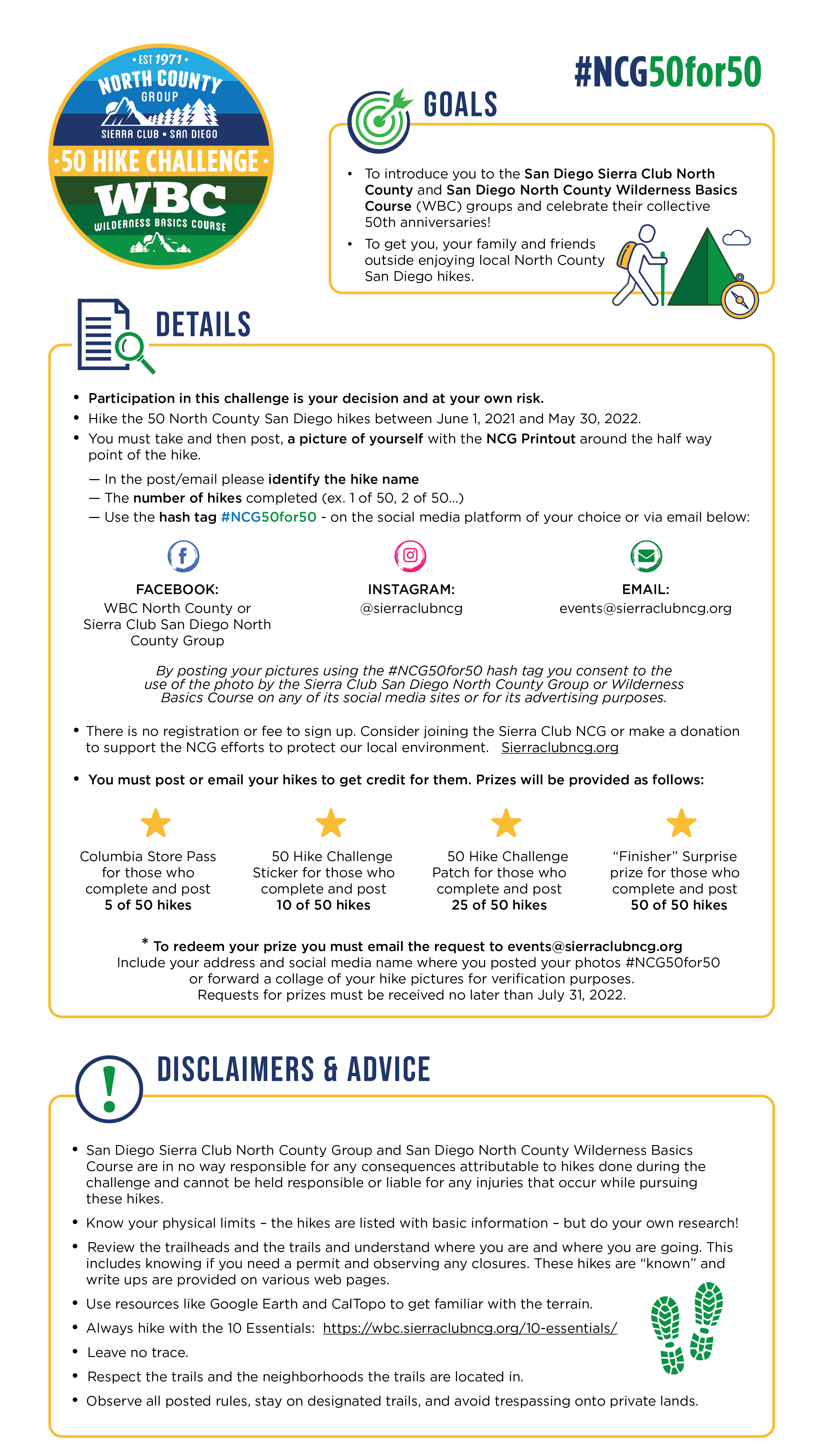
Sierra Club NCG 50th Anniversary 50 Hike Challenge Rules

To download the 50 Hike Challenge Rules, click here.
50 Hike Challenge Printout

To download the NCG Printout for your hikes, click here. For the NCG Printout with checklist, click here.
50 Hike Challenge Interactive Map and List of Hikes
Click on a hike marker below to view more details and get directions.
List of hikes courtesy of NCG. Map courtesy of RobLabs
50 Hike Challenge List of Hikes:
1. Battle Mountain Trail Apple Maps | Google Maps
2. Bernardo Mountain Apple Maps | Google Maps
3. Black Canyon Apple Maps | Google Maps
4. Blue Sky Reserve to Lake Ramona Apple Maps | Google Maps
5. Boden Canyon Apple Maps | Google Maps
6. Buena Vista Park Loop Apple Maps | Google Maps
7. Caballo Trail to Stanley Peak Apple Maps | Google Maps
8. Cedar Creek Falls Apple Maps | Google Maps
9. Clevenger Canyon North Apple Maps | Google Maps
10. Clevenger Canyon South Apple Maps | Google Maps
11. Coast to Crest San Pasqual Valley Apple Maps | Google Maps
12. Daley Ranch – Boulder Loop Apple Maps | Google Maps
13. Daley Ranch – Englemann Oak Trail Apple Maps | Google Maps
14. Daley Ranch – Ranch House Apple Maps | Google Maps
15. Del Dios Highlands Preserve Trail Apple Maps | Google Maps
16. Double Peak Trail Apple Maps | Google Maps
17. Elfin Forest Recreational Reserve Apple Maps | Google Maps
18. Ellie Lane Trail Apple Maps | Google Maps
19. Fry Koegel Trail Apple Maps | Google Maps
20. Hellers Bend Preserve Apple Maps | Google Maps
21. Highland Valley Trail Apple Maps | Google Maps
22. Inaja Trail Apple Maps | Google Maps
23. Iron Mountain Trail Apple Maps | Google Maps
24. Lake Hodges – North Shore Apple Maps | Google Maps
25. Lusardi Loop Trail Apple Maps | Google Maps
26. Los Jilgueros Apple Maps | Google Maps
27. Love Valley Apple Maps | Google Maps
28. Lower Doan Valley and French Valley Apple Maps | Google Maps
29. Monserate Mountain Trail Apple Maps | Google Maps
30. Mt Gower Trail Apple Maps | Google Maps
31. Mule Deer Trail to Denk Mountain Apple Maps | Google Maps
32. Mule Hill Trail Apple Maps | Google Maps
33. Observatory Trail Overloop Apple Maps | Google Maps
34. Pamo Valley Apple Maps | Google Maps
35. Paradise Mountain Trail Apple Maps | Google Maps
36. Piedras Pintadas Trailhead Apple Maps | Google Maps
37. Questhaven Road Nature Trail Apple Maps | Google Maps
38. Rancho Guajome Adobe Apple Maps | Google Maps
39. Raptor Ridge Apple Maps | Google Maps
40. Santa Fe Valley Trail Apple Maps | Google Maps
41. Santa Margarita County Preserve Apple Maps | Google Maps
42. Santa Ysabel Open Space Preserve East Apple Maps | Google Maps
43. Santa Ysabel Open Space Preserve West Apple Maps | Google Maps
44. Sycamore Canyon Preserve Apple Maps | Google Maps
45. Tooth Rock Trail Apple Maps | Google Maps
46. Twin Peaks Trail Apple Maps | Google Maps
47. Van Damm Mountain Apple Maps | Google Maps
48. Vista Conservancy Nature Trail Apple Maps | Google Maps
49. West Side Road Apple Maps | Google Maps
50. Wilderness Gardens Preserve Apple Maps | Google Maps
